

Buprestid Beetles of Venezuela
Introduction:
by M. Hornburg
(project coordinator)
Area: 916.445 km²
Population: 28,8 mill.
Capital: Caracas
Historical map of the
Greater Colombia (1819-1831)
[including large parts of
the present-day Venezuela]


Venezuela is a country exhibiting an enormous variety of landscapes. A look at the vegetation map reveals a great number of different types of habitats. From mangrove forests in the area of the Lago Maracaibo or Orinoco estuary, over extensive dry areas with thorn shrub and succulent vegetation along the coast and in the state of Falcon running into dry forests and passat forests, up to evergreen rain forests and flood forests in the state of Amazonas, everything is represented. Mountain cloud forests are to be found in the coastal cordillera and the Venezuelan part of the Andes. The two highest peaks of the Venezuelan Andes rise up to 4.981 m (Pico Bolivar) and 4.940 m (Pico Humboldt) and are covered with snow and ice throughout the year. The western flanks of the Andes display a transition from rich alpin-biotope (“Paramo”) to the Orinoco basin in many grades. The area of the Orinoco basin is characterised by savannah scenery, interspersed with forest islands or gallery forests along the major tributaries, and can be flooded in large areas during the rainy season for several months. In the south and southwest of the country, south of the Orinoco and across the country's borders, is located one of the geologically oldest parts of the earth's crust, the highlands of Guyana. A substantial number of table mountains (“Tepuis”), displaying highly endemic plant and animal communities on their frequently clouded summit plateaus, rises several hundred meters almost vertically into the sky. All these multifaceted habitats with their associated biological diversity turn Venezuela into one of the most interesting countries in South America.
Mount Roraima, Bolívar
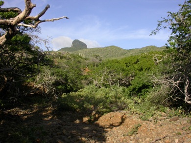
Península de Paraguaná, Falcón
© Copyright 2021. All rights reserved.